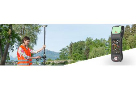
LEICA ZENO 20 GIS GPS SURVEY
Leica Zeno 20 simplifies routine data collection for GIS field personnel. Enjoy the power of cutting-edge technology in an incredibly compact package.
So simple that it will become an indispensable tool.
So accurate that you will always have total reliability.
So productive, it will revolutionize the way you work.
Leica Zeno has been durably built to withstand the elements of any construction site, it is IP67 rated for protection against dust and water. Work from anywhere by downloading the Android application that transfers GNSS positions with RTK correction.
Solve everyday GIS challenges with new technology
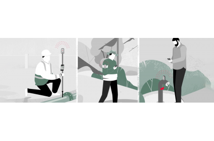
The main challenge for field personnel working with GIS is to find themselves in a non-GNSS environment. Collecting reliable and accurate data is almost impossible in these areas. This problem disappears with the innovative Leica Geosystems technology included in the Leica Zeno 20 GIS collector:
Apogeetec
Even in closed or covered areas such as dense forests, its internal antenna allows accurate positioning data to be collected. At its peak performance: capture more data, more easily.
Gamtec
Be more productive, increase safety and save time by combining the Leica Zeno 20 GIS collector with the Leica DISTO S910 laser distance meter. Say goodbye to the difficulties of accessing difficult or dangerous points - you just have to direct it and collect data instantly, anywhere and at any time.
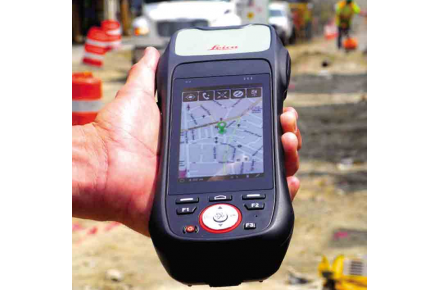
More precision, greater time savings, increased productivity - do it all with the Leica Zeno 20 GIS collector and its improved satellite reception with stronger signals and non-contact measurement. The GIS solution is a comprehensive and unsurpassed solution.
Leica Geosystems, ESRI enhances GIS with ZenoCollector
The leader in measurement technology has teamed up with the leader in GIS technology to bring you an innovative solution for mobile data collection. The rugged Leica Zeno 20 combines with the powerful ArcGIS Collector to create the ZenoCollector. With the Collector for ArcGIS and its main user interface in combination with the one-year ArcGIS Online subscription, the ZenoCollector:
Save time automatically by syncing changes in the field with company information
Increase productivity by opening access to the latest data in the field.
Increase accuracy with professional GNSS coordination
With the simple and intuitive new development of the Zeno 20, prior training is no longer necessary
- It is possible to measure in a single observation several elements that are in the same location.
- Interaction with the map using Zeno Mobile is as simple and intuitive as using a smartphone
- Ease of immediate use allows you to start your projects in the field with the necessary data collection
- Manage and improve the quality of your data. As precise as you need it: from the meter to the centimeter.
- One-click access to high-quality, professional images with the built-in Hexagon Imagery program.
- Zeno Mobile is supported by Zeno Office and works with a wide variety of GIS systems